Regulatory and vacant-land analysis
Zoning against the built city
The footprints of 261,000 buildings compared parcel by parcel with current zoning: Cancún has 4,123 ha of vacant land where zoning already allows 115 million m².
In one sentenceHelps decide where to use land that zoning already permits before opening new land.
Spanish original: La norma contra lo construido
How much city already has permission?
An urban plan says how much can be built; the city shows how much was built.
This atlas compares both, parcel by parcel, and identifies the capacity zoning already grants on vacant lots.
Key findings
Vacant land with permission
46,000 parcels — 45% of zoned area — are vacant, and zoning already allows 115 million m² on them.
Vacant land on corridors
59% of the primary corridor and 74% of the regional corridor are vacant: they hold 46% of the capacity.
Not every vacant lot is a good bet
Only 13% of vacant capacity is where at least 30% of jobs can be reached in 45 minutes by bus.
Approach
Step 1
Assign every building footprint to the parcel that contains it and measure actual coverage against permitted coverage.
Step 2
Identify vacant lots with an explicit rule and compute the m² current zoning already allows on them.
Step 3
Cross vacant capacity with job accessibility by bus.
How to read it
- The building layer has no reliable heights (its height field is surface elevation): floors and built floor-area ratio are not estimated.
- Some vacant lots may have recent buildings not yet in the layer.
- Capacity is the regulatory maximum, without environmental or infrastructure constraints.
Data
Zoning layer
Parcels with zoning key, coverage, floor-area ratio, floors and maximum height.
Buildings
330,000 building footprints.
Job accessibility
Jobs reachable in 45 minutes by bus (from 'One hour by bus').
What supports the method
- Manual (2023)Taxing land rather than buildings pushes vacant land into use (p. 168); action polygons allow vacant and underused parcels to be developed (p. 242).
Paraphrased; page numbers refer to the PDF consulted. The library is in Spanish.
What you just saw
Parcel-by-parcel comparison of building footprints with current zoning.
What else this method can answer
- Which zoned corridors are still empty?
- Which fiscal or management tools would activate vacant land?
- Where does the built city already exceed what is allowed?
In other places
Replicable in any city with parcel-level zoning and a building-footprint layer.
Line of work
A · Zoning, land and urban capacity →Do you have a similar question in your city?
Describe the problem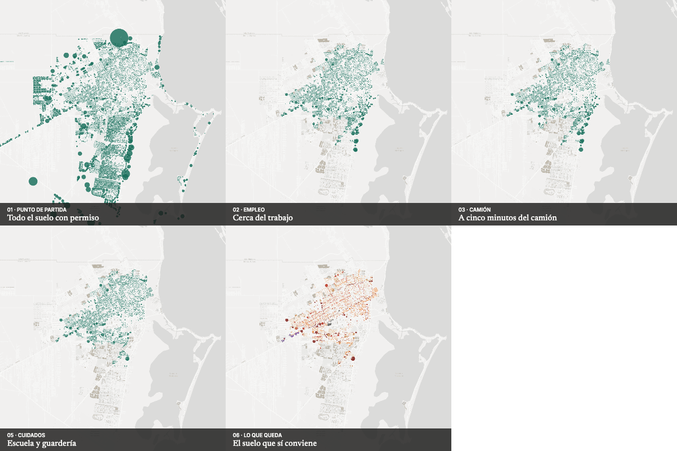 Next in Land, housing and zoningWhere to grow?