Consulting · Line A
Zoning, land and urban capacity
How much does zoning allow, how much fits and where should the city grow?
Plans assign intensities and uses, but rarely measure how much of that is buildable, how much is already built and where it should happen. Without that reading, zoning is debated in the abstract and growth is decided parcel by parcel.
Questions it answers
- How much of the city already has permission and is empty?
- Which part of the plan's potential cannot be built?
- Does the intensity assigned by the plan follow accessibility and services?
- Which permitted land should be used first?
- Where, and how much, should a corridor be intensified?
How it is done
- Read the rulesTranslate zoning, ratios and restrictions into parcel-level rules, with legal judgement.
- Model capacityCompute what zoning allows and what fits on each lot.
- Compare with the built cityContrast with building footprints, population and activity.
- Filter with explicit criteriaAccessibility, hazard and services as visible conditions, without opaque scores.
Data
- Parcel-level secondary zoning
- Building footprints
- Population and housing census
- Business directory (DENUE)
- Computed accessibility
The official zoning layer or the current plan is enough; everything else comes from open sources.
Possible deliverables
- Vacant-land inventory with capacity
- Regulatory gap by lot and zone
- Suitability map with filters
- Technical note with a legal reading of the instrument
- Interactive atlas
Usually useful for
- Planning institutes and departments
- Municipal governments and councils
- Developers and real-estate funds
- Firms that draft plans
Projects that back it
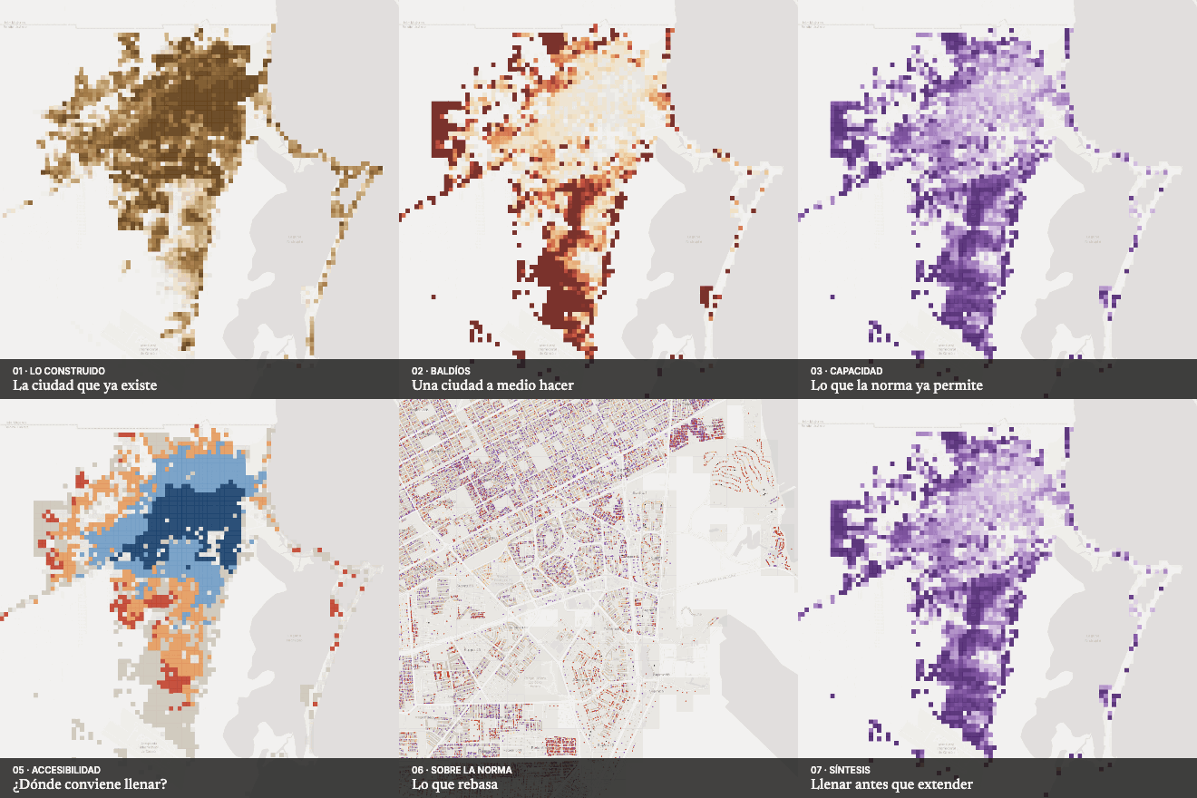 Zoning against the built cityHelps decide where to use land that zoning already permits before opening new land.
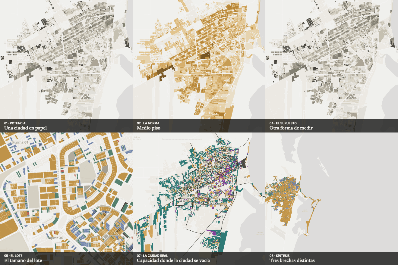 Can the plan be built?Distinguishes which part of a plan's potential is real and which depends on drafting or modelling.
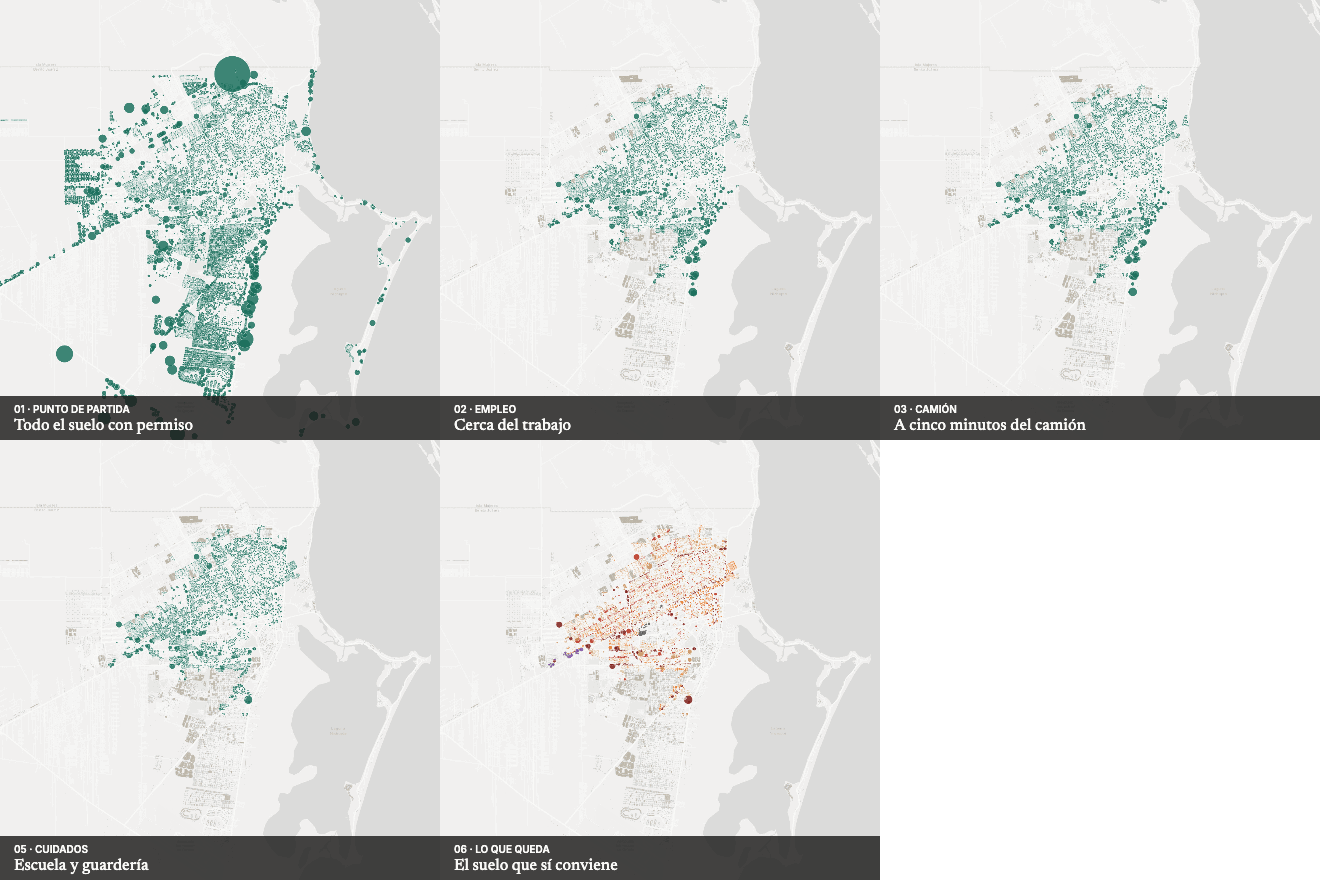 Where to grow?Chooses, with explicit conditions, which permitted land to use first: here 11% of the capacity survives.
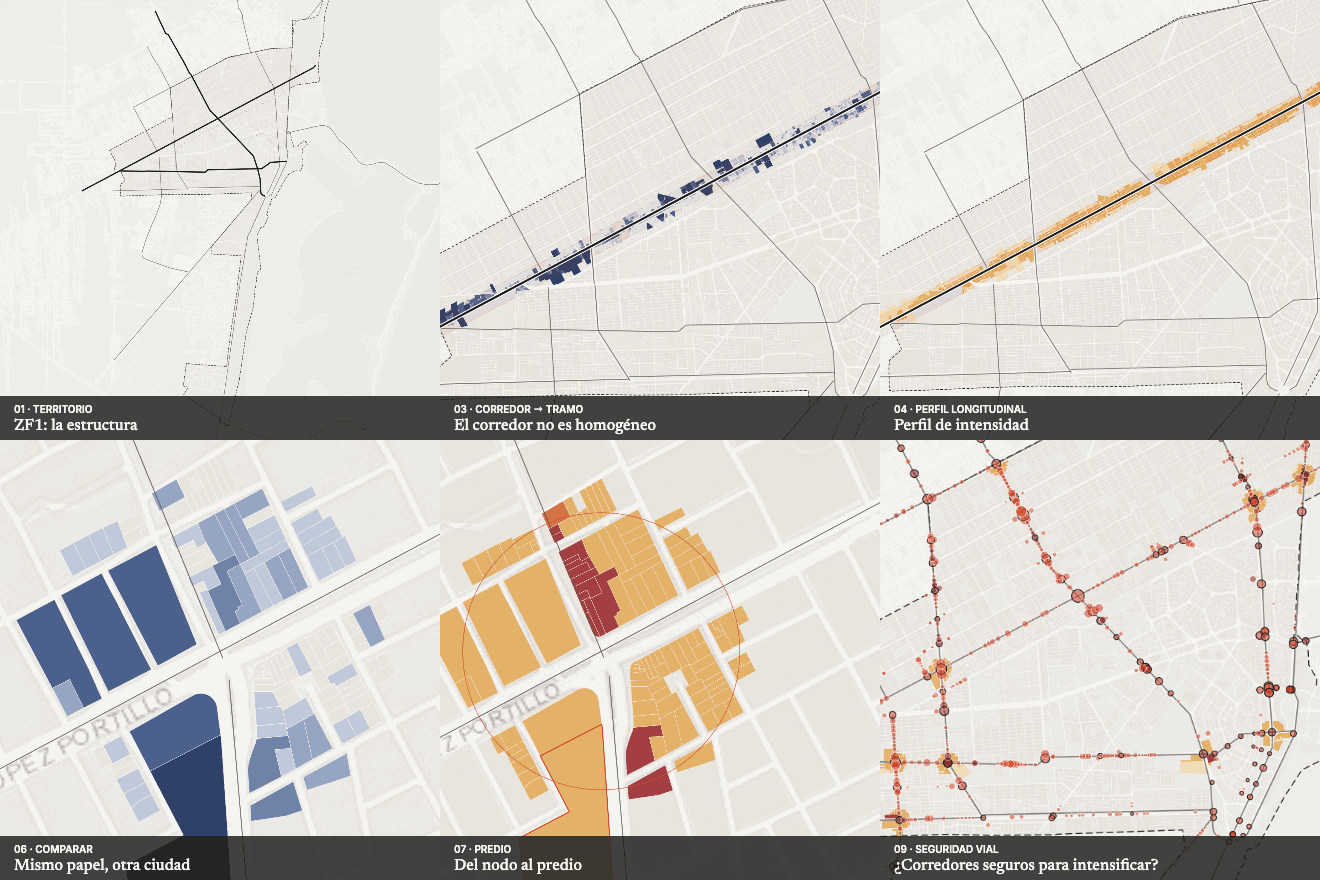 Selective intensityHelps decide where and how much to intensify a corridor, going down from segment to parcel.
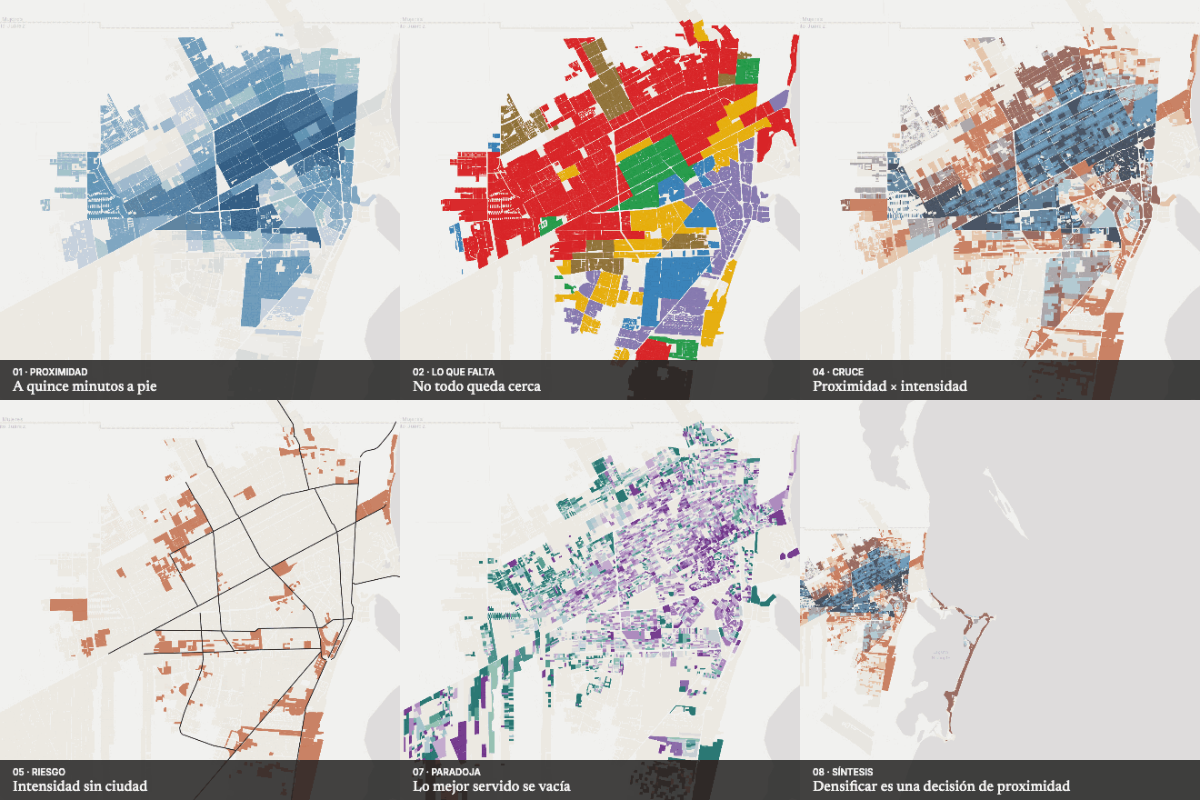 Densify where there is city?Tests whether the plan's intensity follows real proximity: here it matches for 18% of the population, less than chance.
Reference reading
From the library, which is organised in Spanish; titles appear in their original language.
- Instrumentos para el financiamiento de la ciudadManual · 2023
- Guía para la delimitación de los centros de poblaciónSEDATU · 2024
- Guía en materia de planeación municipalSEDATU · 2024
- Planeamiento urbano para autoridades localesONU-Hábitat · 2015
- Guía práctica para la elaboración de planes urbanos2024
- Orientaciones y buenas prácticas de viviendaINFONAVIT / ONU-Hábitat · 2023
- El pulso y el impulso del desarrollo urbano en MéxicoCONARED · 2024
Review a planning instrument
Tell us what you want to decide. The request arrives with this line already selected.
Propose a project