00Territory · evidence · decision
We read the city
to make better decisions.
Cartograma is an urban intelligence and territorial strategy practice. We study spatial relationships, change and inequality to inform decisions about the city.
We work with governments, planning and mobility departments, institutions and developers.
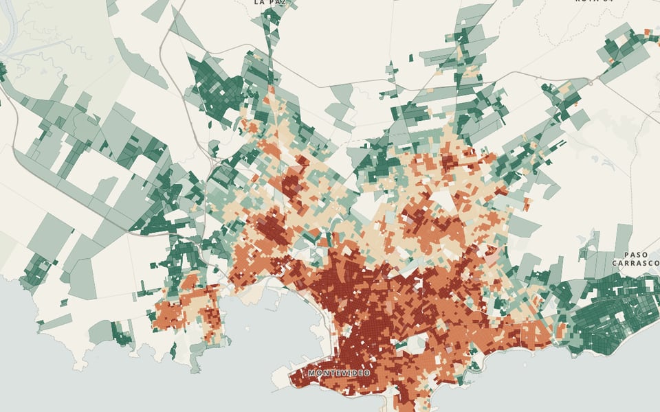
NewEveryday Proximity Index · MontevideoMontevideo’s 9,847 inhabited census zones, measured with the same method as in Mexico, Colombia and Spain. Further down this page. ↓01 · A demonstration · Montevideo / UY
What lies within fifteen minutes?
What you can take care of close to home depends on the neighborhood. We measured it in Villa Española.
This segment of Villa Española is one of the 1,028 INE census segments the city is divided into. All of them are measured the same way.
What lies within fifteen minutes? What you can take care of close to home depends on the neighborhood. We measured it in Villa Española.
- 1,508 people in one census segment of Montevideo This segment of Villa Española is one of the 1,028 INE census segments the city is divided into. All of them are measured the same way.
- Each dot, a group of homes Each census zone, usually a single city block, has a dot with the people who live there according to 2023 population figures. Trips start there, not from the center of the neighborhood.
- In Villa Española, 14 starting points Its 1,508 people live in 14 census zones. A trip starts from each one.
- From the front door to the street Each dot is joined to the nearest sidewalk or path, about 39 m away. That is where the walk begins.
- Walking follows the street, not a straight line At a normal pace, fifteen minutes cover 1,249 m along streets and paths.
- On foot: 278 places in 15 minutes Grocery stores, schools, health clinics, squares, libraries and transit stops: everything within a fifteen-minute walk from the 14 zones.
- By bicycle: 1,227 places In the same 15 minutes a bicycle covers 3.1 km and reaches 4.4 times as many places as on foot.
- By car: 1,423 places In rush-hour traffic, 12 minutes behind the wheel reach 3.8 km. The car reaches only 16% more places than the bicycle.
- Summary · Villa Española The bicycle multiplies what lies within fifteen minutes on foot by 4.4; the car, at rush hour, adds only 16% more.
The index compares the 9,847 inhabited census zones of Montevideo with a different measure: the street distance to the nearest place of each function.
02What we do
That demonstration answered one question. Here are the rest.
Our work is analysis: we turn public data and each organization’s own records into a reading of the territory that can be used to make decisions, and to explain them.
We organize it into three practice areas. Choose the one closest to your question: there you will find what we deliver and the cases that show it.
- Area 01
Land and Urban Regulation
Understanding what can happen in a territory, where, and under what rules.
For those making decisions about the future of a territory.
We help you decide where to grow, what to allow and where to invest, based on what the territory allows today and what is changing.
Questions we answer
- What can be built on this parcel or in this area?
- Where is it best to grow without moving away from jobs and services?
- What changes if the rules change?
Every project starts from your question; the scope is defined with you.
- UruguayWhere is Montevideo building? →9.3 new m² per person where proximity is highest; 2.2 to 3.5 where it is lowest
- MexicoWhere can Cancún grow? →Only 17% of what can be built on vacant lots is well connected to jobs
- ColombiaWhere is Bogotá growing? →28% of new construction goes where proximity is lowest, home to 18% of the people
- SpainWhere do Spanish cities build? →42.7% of new housing goes where proximity is lowest, home to 20% of the people
- Area 02
Mobility and Accessibility
Understanding who can reach what, from where, and how quickly.
For those who need to know how a location connects to the rest of the city.
We help you see who can reach what and how quickly, and where an intervention changes access the most.
Questions we answer
- What can each neighborhood reach in fifteen minutes, or in an hour by transit?
- Which crossing or street should be fixed first?
- Did the project that was built work?
Every project starts from your question; the scope is defined with you.
- UruguayWhere do people get hurt on the street? →18% of Montevideo’s street kilometers account for 67% of people seriously injured or killed
- MexicoDid fixing Cancún’s crossings work? →The 35 crossings that were fixed had 42% to 48% fewer crashes than expected
- ColombiaWhich Bogotá crossing to fix first? →Only 11 of the top 100 crossings match between spatial justice and road safety
- SpainWhat is out of reach for older people? →Walking slowly, 33.2% have the health center more than 15 minutes away; the pharmacy and the shop stay close
- Area 03
Urban Operations
Understanding how the everyday city works, to decide where and how to act.
For those who manage networks, services and operations spread across a territory.
We help you read your records to find where service fails and what to address first.
Questions we answer
- Where does service fail, and why?
- Which places need attention first?
- Are promises being kept?
Every project starts from your question; the scope is defined with you.
- UruguayIs waste collected on time? →Late on 2% of days in central Montevideo and on 21% to 24% in the outskirts
- MexicoAre reports in San Pedro resolved on time? →They are assigned the same day; fixing the pavement takes two weeks
- SpainWhere to open climate shelters? →19.4% of Seville’s population has a shelter within 15 minutes; 99.6% in Barcelona
03New · Everyday Proximity Index · Montevideo
How close is everyday life in Montevideo?
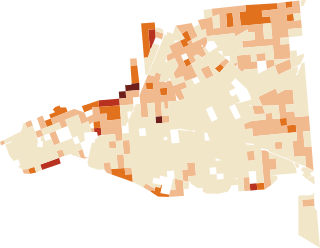
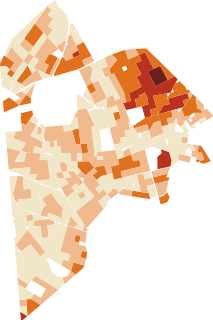
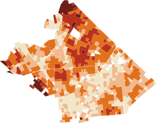
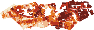
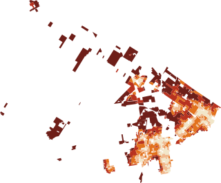
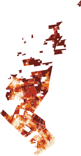
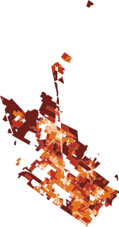
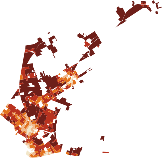
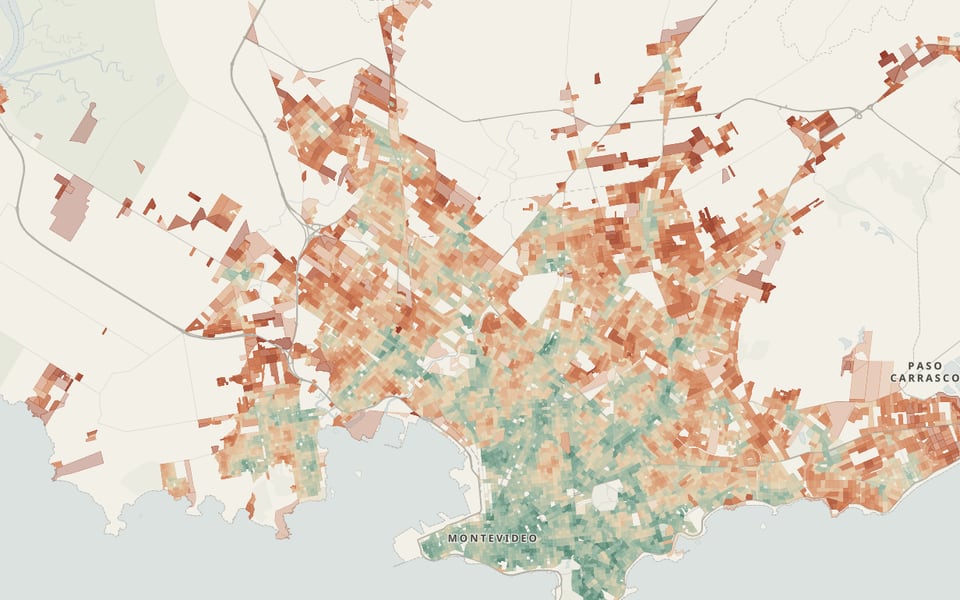
We repeated the demonstration’s measurement across Montevideo: for each of the 1.27 million people in its 9,847 inhabited census zones, we measured the walking distance along the network to food, education, health, recreation, culture and transit, and compared it with everyone else’s. Half of the people reach 51.2 points or more. By municipality, the index goes from 32.9 in Maroñas to 72.7 in Centro. 48% have all six functions within a fifteen-minute walk; what is most often missing, according to the places recorded in OpenStreetMap, is culture and health.
See the indexMeasure your neighborhoodThe index in each of Montevideo’s eight municipalities
less proximitymore
New · Projects · Montevideo
Five questions about Montevideo, each with its own atlas.
With the Intendencia’s operating records: whether waste is collected on time, how long complaints take, how close everyday life is, where people are injured in the street, and where the city builds and where it is hot.
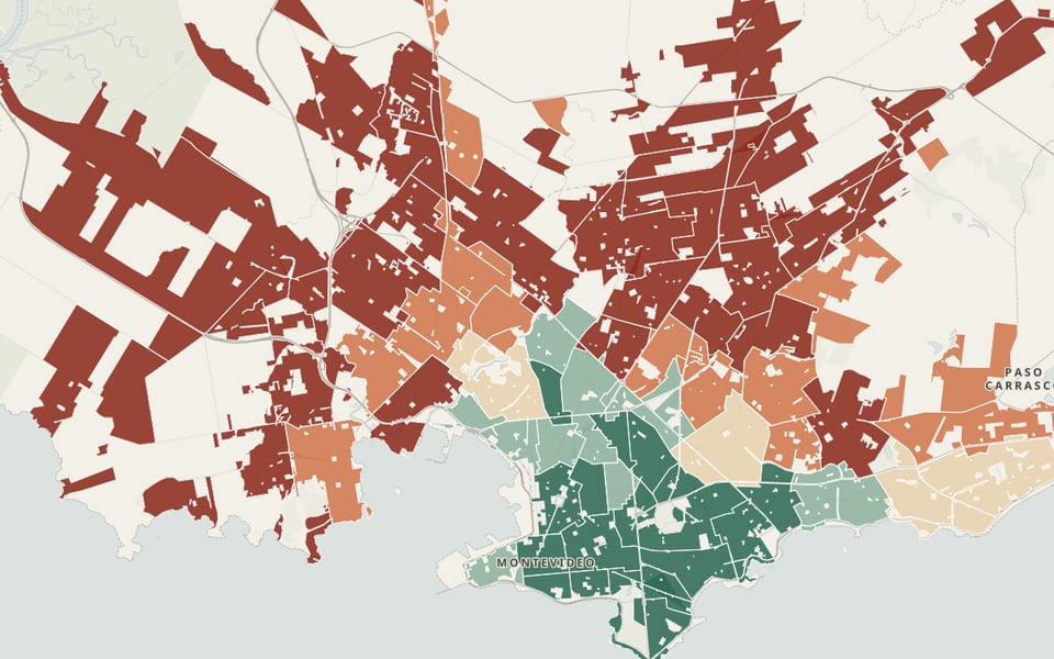
The center gets collected on time; the outskirts do not
Collection runs late on 2% of days in the Centro and Pocitos municipalities and on 21% to 24% in Cerro, Casavalle, Maroñas and Colón. Complaints do not show it.
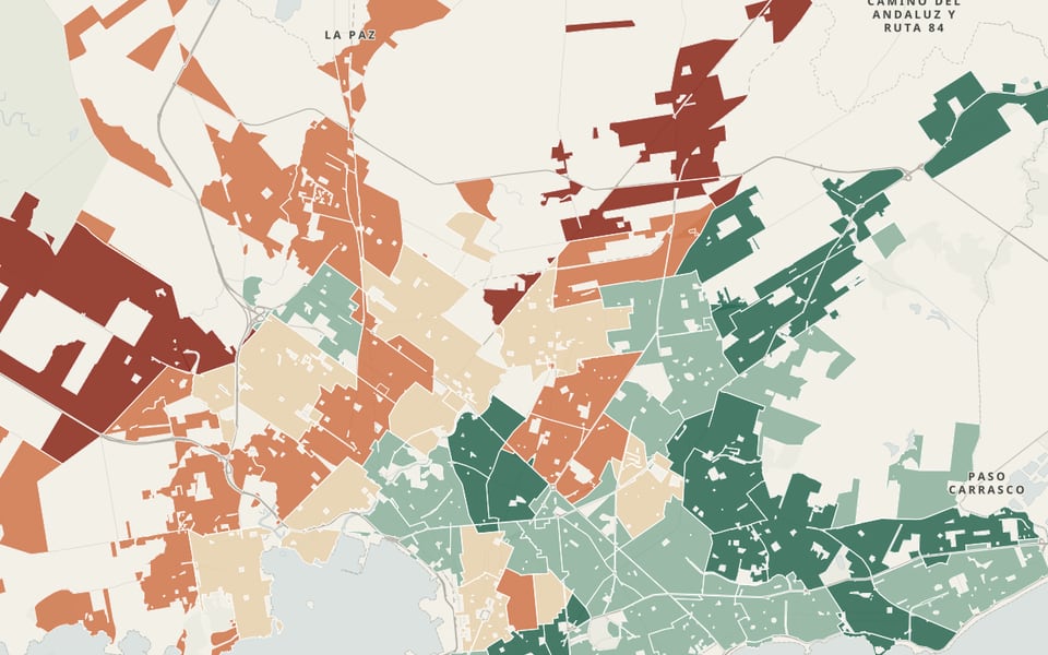
The outskirts wait twice as long
1.7 million complaints: the west and north wait 14 to 17 days; the center, 6 to 7.
Close to everything on the coast, far away at the edge
The index ranges from 70.4 in the Centro municipality to 34.7 in Maroñas; culture and health care are what is missing most.
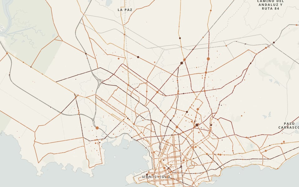
A few avenues, most of the serious injuries
The main roads are 18% of the kilometers and account for 67% of people seriously injured or killed.
Montevideo builds where the city already is
9.3 new m² per person in the highest proximity quintile; that part of the city is also the hottest.
04Contact
What do you need to decide about your territory?
Every project starts with a good question. Tell us yours, and we will reply with a first reading of the problem.
Discuss a project